Easy Hiking Trails Near Park City, Utah
When you think of Park City, Utah, you probably think snow and winter. That's a fair connection considering the 2002 Winter Olympics were hosted here and the Sundance Film Festival happens every January (I was fortunate to attend). But there's so much more to Park City than its superb snow sports conditions.
This summer, I traveled to Park City to photograph a corporate event. I spent most of the long weekend at the Montage Deer Valley and had some occasional bouts of free time. What to do? I considered trips to Historic Main Street via Park City's free transit system. But the blue skies and sunny 78º weather were calling my name, so hiking it was!

The view from the a point on the Park City Resort Trail.
Tips for Hiking in Utah
All of the hiking trails in Deer Valley are impressively maintained and well marked. It's very difficult to get lost while on a trail. However, it's always a good idea to carry a trail map (they're free at most resorts), or download the map to your phone via AllTrails. Also, don’t forget to bring a bottle of water and a day pack, or camping gear if you plan to spend the night.
Altitude Sickness Alert
Summer weather in Utah is phenomenal, with daytime temperatures usually in the high seventies and nights and much cooler nights. However, Utah is very dry and at a high elevation (the third-highest state in the USA) of 6,100 feet. This can cause varying degrees of altitude sickness, so be sure to take it easy while doing any physical exercise.
1. Park City Mountain Ski Resort Trail
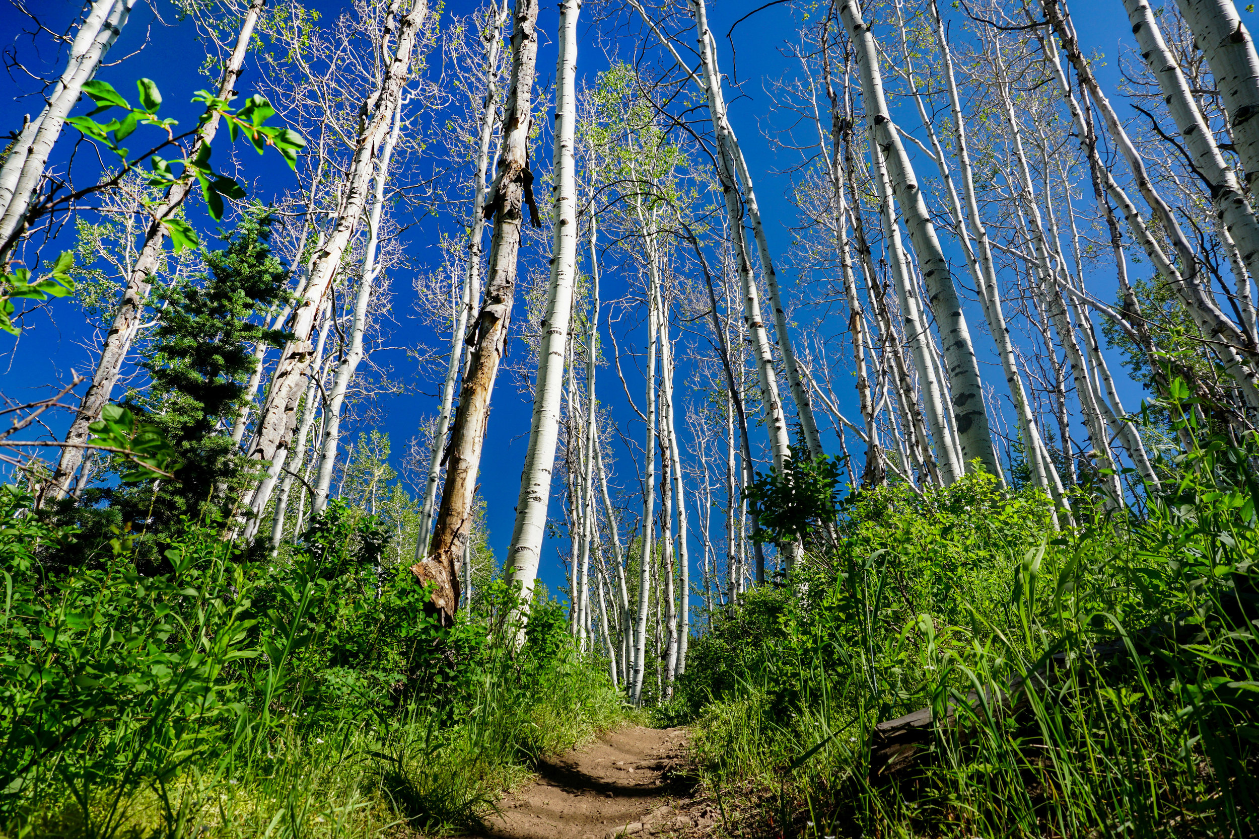
One of the best parts about Park City is the ski lift, runs, and trails that start directly from this small Utah town. The Park City Mountain Ski Resort Trail is 18.2 miles in total, but you don’t need to do this whole loop. Treat it like an out and back trail and make it any distance that you’d like. The trail follows many winter ski runs. It takes you through Aspen and pine trees, and lots of lovely wildflowers. After you’re done hiking, head into town and grab a coffee at Atticus or a healthy brunch at Harvest.
Park City Mountain Trail Resort Map
2. Gambel Oak Loop
East of the Park City Mountain Resort Trail, you’ll find the Gambel Oak Loop. This is a 3.9-mile easy hike with an elevation gain of 629 feet. The trail begins on a residential street in a neighborhood called April Mountain, not far from Main Street. Trail markers are not the best; when in doubt, follow the signs for Masonic or Prospector Loop Trail. There are great scenic views of Old Town and the valley, and if you’re lucky, wildflowers.
Gabel Oak Loop Trail Map
Deer Valley, Utah
Situated about 1.7 miles above Park City's Main Street, Deer Valley is home to several top ski resorts. In the summertime, ski lifts and paths turn into miles of hiking and mountain biking trails. Many of the chairlifts run during daytime hours in the summertime. For a fee, you can ride the lift to the top of several mountains. Some lifts are even specialized to carry mountain bikes. Of course, you can always hike your way up the mountains on foot if you want an extra work out. The best compromise is to ride the chairlift up and hike down.
3. Deer Valley Resort Trail
My favorite hike in this part of Utah is the Deer Valley Resort Trail. It’s part of a 7.6-mile loop that is accessible year-round. I only hiked a portion of it from Montage Deer Valley to nearby Silver Lake Village. It was a 60-minute, mostly flat trail with lots of shade thanks to the many Aspen trees. The path is shared with the occasional small group of mountain bikers. They are very self-aware and courteous in terms of letting you know they are coming and leaving room for you on the path.
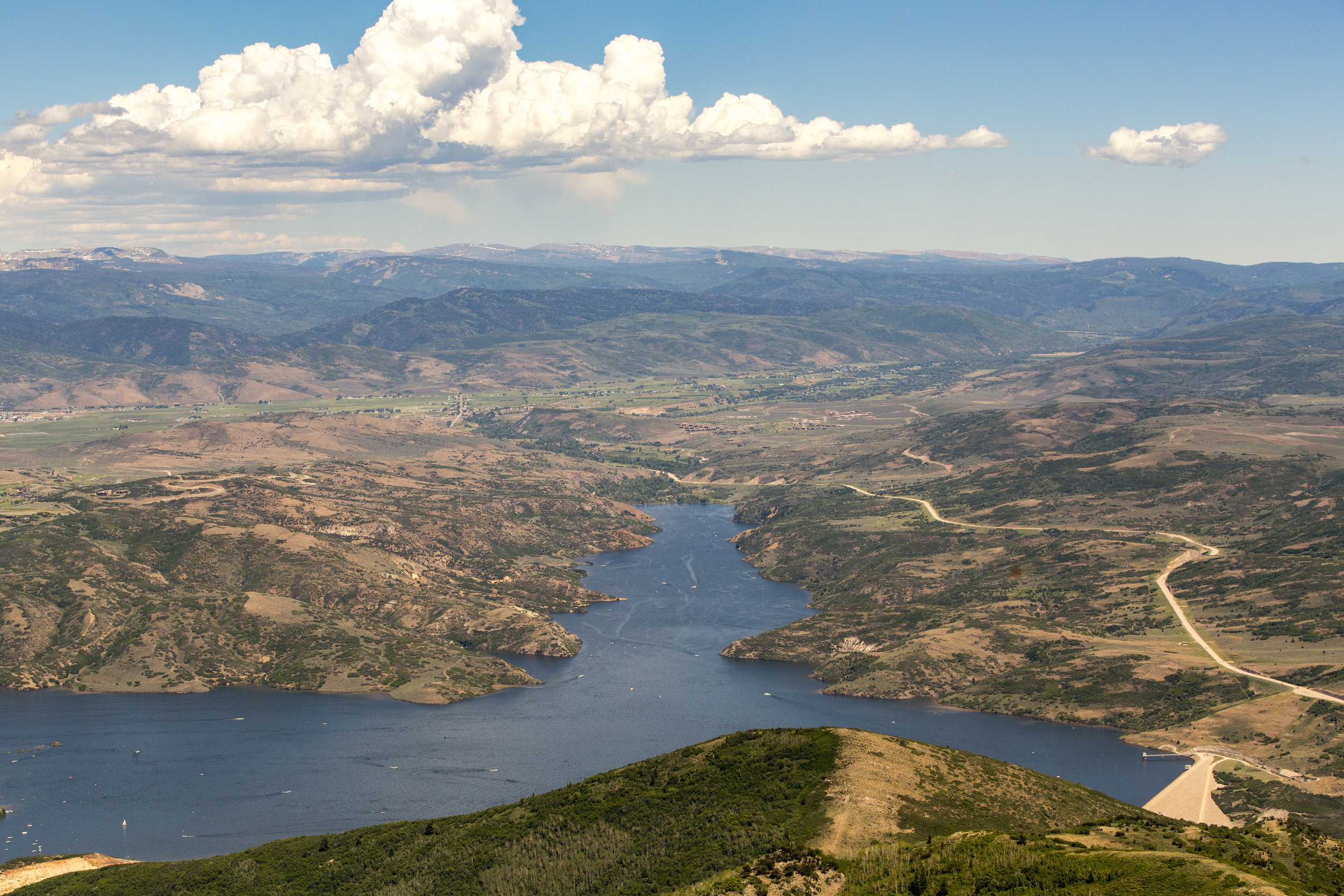
Upon reaching Silver Lake Village, there are restrooms and opportunities to buy food and drinks. You can also inquire about other summer activities, such as mountain biking which is very popular at Silver Lake in particular. Chairlift tickets can also be purchased if you choose to ascend the mountain in the easiest way possible. The chairlift is a scenic ride that takes you to the very top of the 9,400-foot tall Bald Mountain. The views up here are breathtaking, offering stunning views of the Jordanelle Reservoir and the Uinta Mountains.
From the top of Bald Mountain, you can take other hiking trails if you wish to continue exploring. Or you can opt for the 2-mile hike down, which includes a 1,300 vertical decline. Or you can simply hop on the chairlift to get back to the bottom in minutes.

Other Hikes
The Bald Mountain via Ontario Trail is another popular hiking option that offers very different views than the Silver Lake Trail. It’s a 5-mile out-and-back trail that terminates at the top of Bald Mountain at 9,400 feet. There’s an elevation gain of 1,266 feet and some parts that might classify this hike as moderate by some standards.
In Conclusion
If you’re visiting Park City, Utah, and are short on time, pick any of these easy hikes to get a taste of the nature in the area. Remember, if a hike seems too long or challenging, it’s okay to turn back and cut the hike short. Often times, you can get a spectacular view without completing the entire trail.
Find this post helpful? Please share it, or pin it for later.